Pixel-verified river basin intelligence for the enterprise.
Sentinel-2 at 10 m, rolled into Basin Health Scores you can drop next to CSRD, CSDDD, or board slides. Each figure ties back to CDSE stats and scene IDs, not a black box.
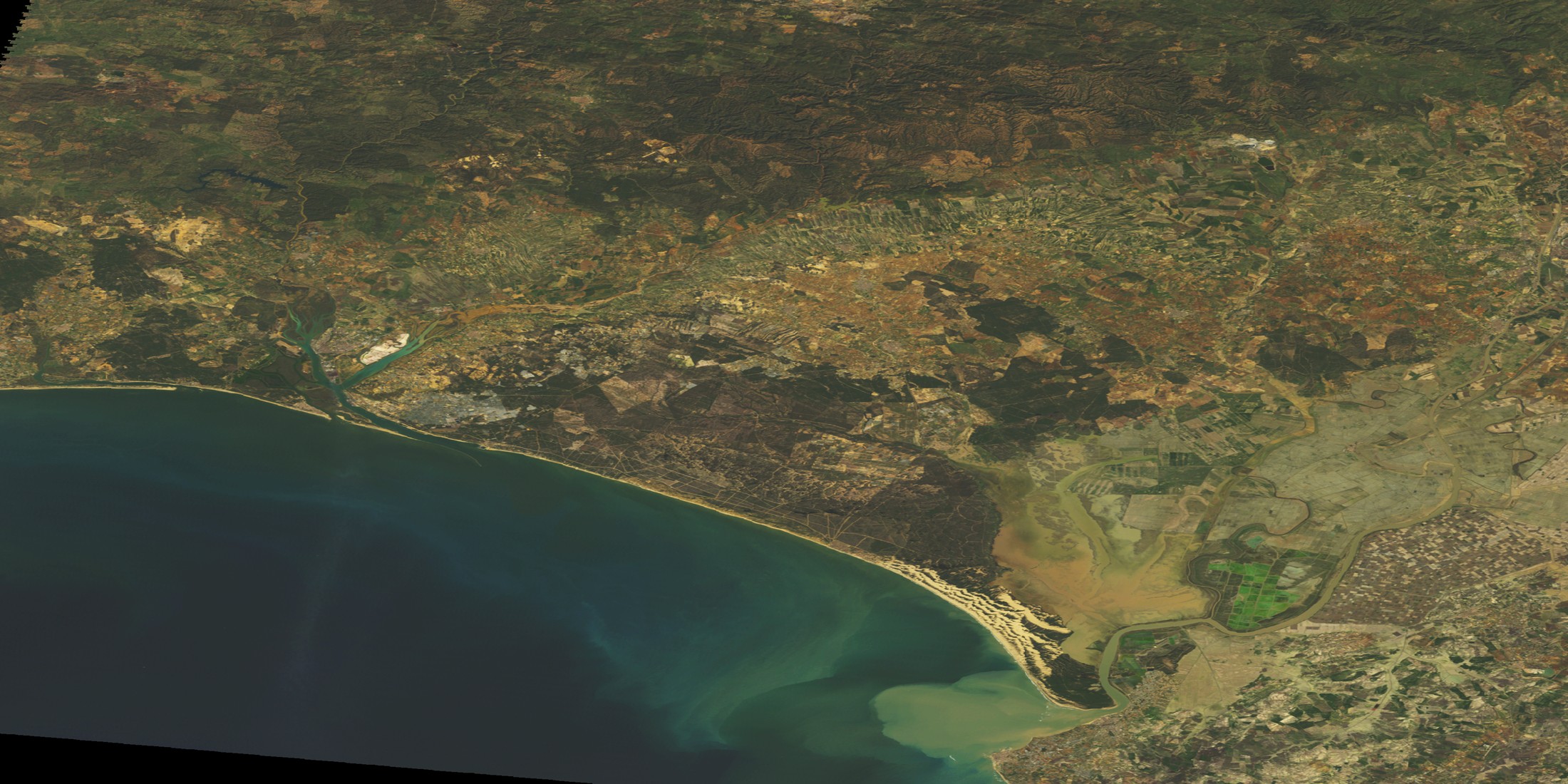
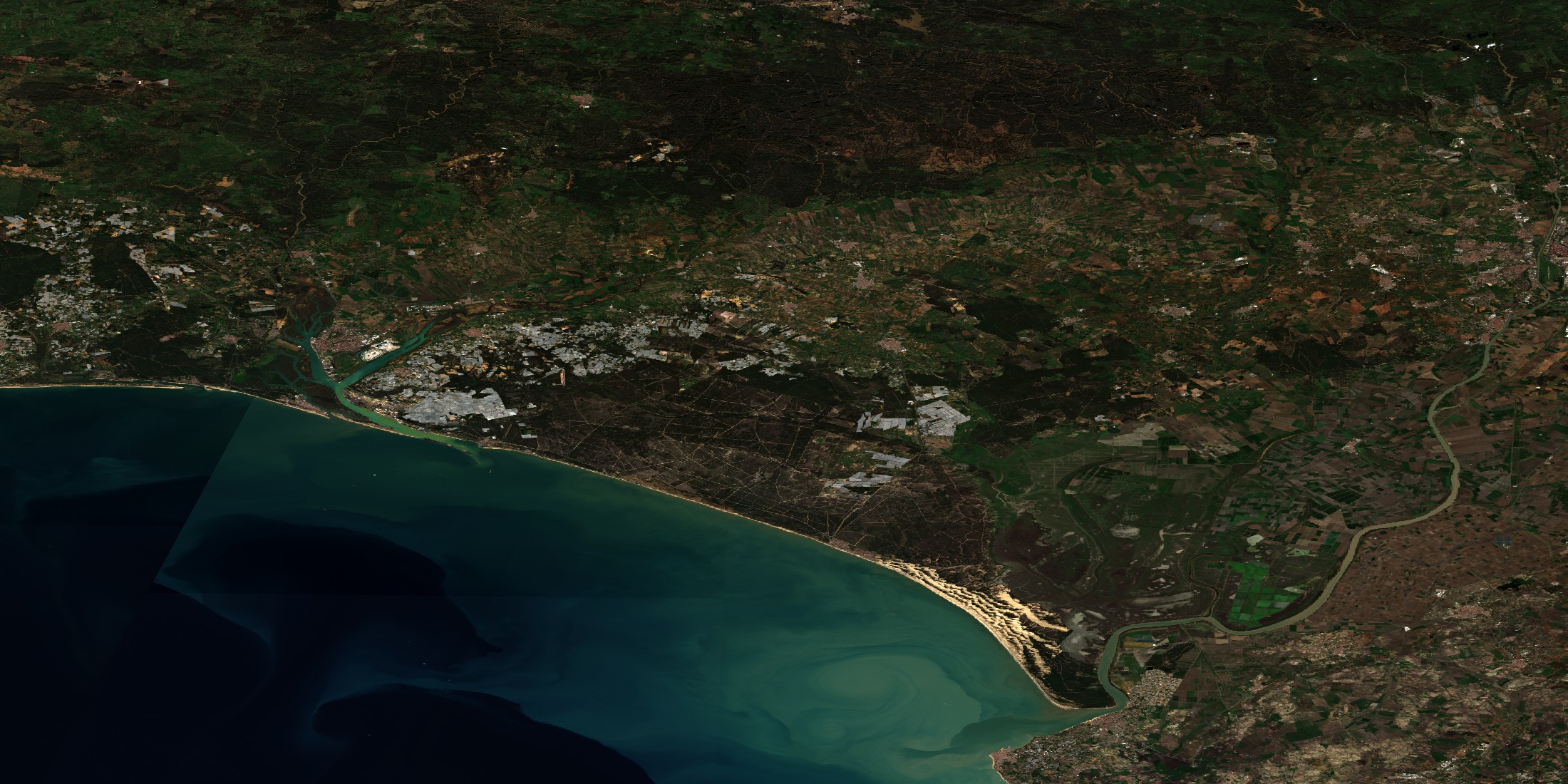
Comparison imagery: Landsat 5 in 1997 next to Sentinel-2 in 2024. Separate from the numeric Basin Health Score inputs. Wet read bright in 1997; by 2024 the same reach looks drier with less open water.
Powered by EU space infrastructure
CASSINI Space for WaterWater intelligence you can defend without extra field crews.
Operator spreadsheets go stale. Satellites do not. We turn the open Copernicus stack into scores and charts your board can actually argue from.
Basin-scale by default, scalable globally
Five EU basins on one 0-100 index. Live path is Sentinel-2 from CDSE when keys exist, plus ERA5 from Open-Meteo. SAR and OLCI stay off the wire for now but the scorer already has hooks. Same layout can fan out to more HydroBASIN units.
Traceable inputs
Numbers point to scenes, evalscript id, and the bbox that was run. Someone else can rerun the recipe.
Disclosure-ready outputs
Exports carry framework tags, methodology id, and per-layer source lineage so reviewers see how each figure was produced.
Stewardship impact, not just risk
Risk maps show pain. Here you get baseline, trend, and before/after wording that fits VWBA 2.0 and SBTN Step 5 style questions.
One evidence layer for the water threads you already run.
Same charts for CSRD, CSDDD, SBTN, and TNFD people so they quit rebuilding the same map. Counsel and assurance still own what actually gets filed.
CSRD
ESRS E3, water and marine resourcesExports line up with the same four framework rows as the compliance JSON bundle. Enough for E3 style workshops; full E3 grid coverage is later work.
- E3 style evidence
- Stress maps
- Provenance notes
CSDDD
Value-chain water riskKeeps basin signals current while you hold the supplier list. Maps and trends only, not a legal opinion.
- Basin context
- Intervention dates
- Traceable inputs
SBTN
Freshwater moduleHands step 2 and 3 workshops satellite baselines. Still need SBTN’s own tools and sign off for targets.
- Quantity story
- Quality story
- Basin short list
TNFD
LEAP (locate, evaluate, assess, prepare)Gives nature risk teams maps and slopes for LEAP style reviews. Final TNFD text stays with you and your assurance partner.
- Hot spots
- Dependencies
- Scenario hooks
From raw photons to a defensible Basin Health Score.
One pipeline, public inputs, versioned maths. Built so an auditor can follow the thread.
- 01
Ingest
Sentinel-2 L2A stats from CDSE plus STAC ids. Rain from Open-Meteo ERA5. No SAR fetch yet. Habitat NDVI uses the whole basin box until we ship a real riparian mask.
- 02
Compute
Pinned evalscripts output NDWI, MNDWI, NDVI, NDMI, Nechad turbidity, and a simple Chl-a proxy at 240 m in the operational API path. Rain is a rolling 30 days vs 1991-2020.
- 03
Score
Default blend: Quantity (water plus moisture plus rain), Quality (turbidity and colour), Habitat (NDVI and bare soil), fixed 45 / 35 / 20, then red / amber / green. Optional withdrawal and policy subscores can load from static tables.
- 04
Disclose
JSON and CSV pack framework hooks (CSRD, CSDDD, SBTN, TNFD), methodology hash, source states, and caveats, aligned with the compliance export schema. Asset rows include certified accuracy metadata where supplied.
Copernicus-first basin intelligence
Live scores lean on Sentinel-2 from the Copernicus Data Space, ERA5 rain from Open-Meteo, and HydroBASINS outlines. The big before/after on the homepage is Landsat plus Sentinel for story only; it does not feed the number today. SAR, OLCI, live Galileo, and air-quality overlays are queued behind that core path. No secret vendor layers in the shipped stack.
10 m, ~5 day revisit. NDWI, NDVI, turbidity, Chl-a proxy. With CDSE enabled, the Statistical API feeds quantity, quality, and habitat together with ERA5 rain.
SAR belongs in Quantity. The running stack today is Sentinel-2 plus rain; CDSE SAR evalscript integration is next.
30-day totals vs a 1991-2020 baseline from the Open-Meteo ERA5 archive. Same reanalysis family as Copernicus CDS; the app uses Open-Meteo as the operational archive endpoint.
Asset records include accuracy metadata next to coordinates. GNSS service integration is planned. Survey-grade facility corners follow next.
Open, scientific, and continuously updated.
The status column shows what the product stack exercises today versus what is scheduled next. Core inputs stay on open Copernicus and public geometry; no paywalled black-box feeds.
| Source | Spatial | Cadence | Status | Used for |
|---|---|---|---|---|
| Sentinel-2 MSI | 10–60 m | 5-day | Active | NDWI, NDVI, MNDWI, NDMI, turbidity (Nechad), Chl-a proxy (B05/B04) via CDSE Statistical API |
| Copernicus ERA5 | ~9 km | Rolling 30 d | Active | Rain percentile vs 1991-2020 baseline (Open-Meteo ERA5 archive) |
| HydroBASINS | Vector | Static | Active | Official basin polygons for bbox attribution |
| Sentinel-1 SAR | 10 m | 6-day | Roadmap | Planned SAR soil moisture and flood signal for Quantity |
| Sentinel-3 OLCI | 300 m | 1.5-day | Roadmap | No live OLCI yet; live colour signal is the Sentinel-2 B05/B04 proxy |
| Galileo / EGNOS | Sub-metre | n/a | Metadata | Asset coordinates use stored accuracy metadata; GNSS service integration is planned |
| Sentinel-5P TROPOMI | 5.5 km | Daily | Roadmap | Planned NO2 and CH4 overlays for farm and factory context |
| Landsat 8/9 OLI | 30 m | 8–16 day | Illustration | Hero image only, not in the score engine |
Ready to see your portfolio through a satellite's eye?
Portfolio: Rhine, Po, Danube, Ebro, and Doñana. Basin Health Scores use Sentinel-2 statistics from CDSE when credentials are configured; otherwise precomputed snapshots keep responses fast and consistent. Imagery is served from CDN snapshots with optional live CDSE refresh (see README).